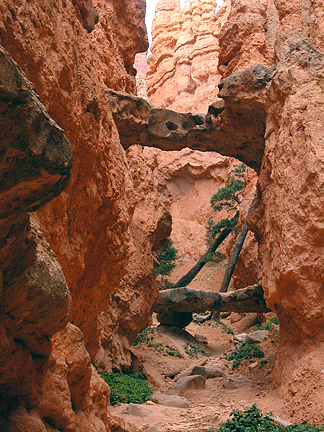
Two Bridges
Location:
Navajo Loop Trail
Sunset Point
Bryce Canyon National Park
County:
Garfield
7.5 Topo:
Bryce Point
Latitude:
N37°37'12.7" (estimated coordinate)
Longitude:
W112°09'41.1" (estimated coordinate)
Trailhead:
From park Visitor Center drive 1.5 miles south to Sunset Point (see park map).
Disclaimer:
All the information on UtahArches.com is published in good faith and for general information purpose only. UtahArches.com does not make any warranties about the completeness, reliability and accuracy of this information. Any action you take upon the information you find on this website (UtahArches.com), is strictly at your own risk. UtahArches.com will not be liable for any losses and/or damages in connection with the use of our website.