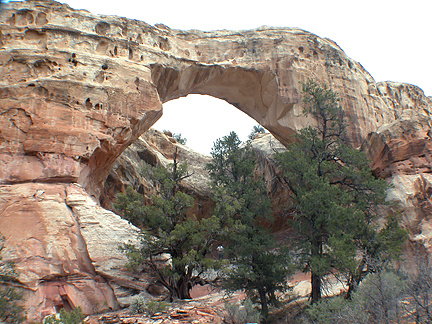
Sam Pollock Arch
Exposure:
W
Location:
Hackberry Canyon
Lower Death Valley
Grand Staircase-Escalante National Monument
County:
Kane
7.5 Topo:
Calico Peak
Latitude:
N37°18'48.6" (estimated coordinate)
Longitude:
W111°56'33.7" (estimated coordinate)
Notes:
Named for Sam Pollock (1885-1965), who grazed cattle in the area, and was Garfield County Commissioner.
Disclaimer:
All the information on UtahArches.com is published in good faith and for general information purpose only. UtahArches.com does not make any warranties about the completeness, reliability and accuracy of this information. Any action you take upon the information you find on this website (UtahArches.com), is strictly at your own risk. UtahArches.com will not be liable for any losses and/or damages in connection with the use of our website.