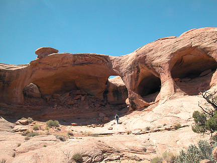
Colonnade Arch Pothole South
Exposure:
E
Location:
North Fork Two Mile Canyon
Keg Point
Misc Utah
County:
Emery
7.5 Topo:
Bowknot Bend
Latitude:
N38°35'11.6" (estimated coordinate)
Longitude:
W110°04'34.2" (estimated coordinate)
Other Names:
Five Hole Arch
Disclaimer:
All the information on UtahArches.com is published in good faith and for general information purpose only. UtahArches.com does not make any warranties about the completeness, reliability and accuracy of this information. Any action you take upon the information you find on this website (UtahArches.com), is strictly at your own risk. UtahArches.com will not be liable for any losses and/or damages in connection with the use of our website.